Projeto
Comunidade
Notícias
Meu aplicativo
Os meus mapas
Mapas de Dürrlauingen
Pesquisa avançada
Todos
Privado
Favoritos
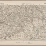
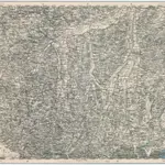
Stuttgart 128, uit: [W. Liebenow's Special-Karte von Mittel-Europa]
1870|Johannes Wilhelm Liebenow 1822-1897
1:300 000
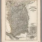
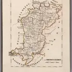
Sudostlicher Theil vom Donau-Kreis im Konigreich Wurtemberg
1850|Radefeld, Carl Christian Franz.
1:460 000
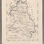
V.2: 6-10: VI: II. Wurtemberg. Der Jaxt Kreis
1825|Hermann, O.
1:110 000
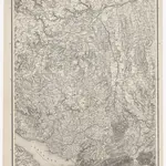
Generalkarte von Württemberg: Blatt IV
1859|Terrainzeichnung: Bach, Topograf und Hauptmann Lithografie: Rebmann und Sommer Herausgeber: K. statistisch-topografisches Büro
1:1 500 000
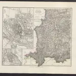
[Augsburg
1874|Militärgeographisches Institut
1:300 000
V.2: 6-10: VI: I. Baiern: 6. Oberdonaukreis
1825|Hermann, O.
1:220 000
Königreich Bayern
1860|Meyer, J.
1600
1650
1700
1750
1800
1850
1900
1950
2000
História
Mapas antigos de Dürrlauingen
Descubra o passado de Dürrlauingen nos mapas históricos
Mapas antigos de Dürrlauingen
Descubra o passado de Dürrlauingen nos mapas históricos
Explorar os mapas
Descobrir a história
Região-mãe
Gunzburgo (distrito)
Locais relacionados
© MapTiler
© OpenStreetMap